Walking the whole Las Vegas Strip takes about 1.5 hours without stops, by our estimate, and realistically 2 to 3 hours once bridges, crowds and detours are added. Below: the math, every resort in order on both sides of the boulevard, the hotels’ own walk times and where the bridges let you cross, as of October 2026.
Quick answer
About 1.5 hours nonstop, by our estimate: most published lengths for the Strip, from the Welcome to Fabulous Las Vegas sign to The STRAT, run from 4.2 to 4.5 miles, and we assume an average pace of about 3 mph. With bridge climbs, casino detours, crowds and stops, plan on 2 to 3 hours.
Checked October 2026 against the federal byway listing, Clark County’s bridge map and the hotels’ own FAQs; how we check facts explains the method.
What changed in 2026
- May 22, 2026: The Cromwell reopened as The Vanderpump Hotel, on the northeast corner of Flamingo Road.
- July 21, 2026: Clark County’s bridge map shows 14 pedestrian bridges, 12 open; the two to the former Tropicana corner, now A’s ballpark construction, are closed.
- Fall 2026: the Monorail closes early on several event dates (at midnight on Oct. 29 and on most nights from Nov. 29 to Dec. 15), so check before you count on it for the ride back.
How long does it take to walk the Las Vegas Strip?
About an hour and a half at a steady, nonstop pace, by our calculation. No hotel, county or tourism source we checked publishes an end-to-end time, so this is our estimate: time equals distance divided by pace, and 4.5 miles ÷ 3 mph = 1.5 hours (4.2 miles takes 1.4 hours, or 84 minutes).
The 3 mph pace is our assumption for an adult walking steadily without stopping. Your own pace matters more than which length you use:
| Pace (our assumption) | 4.2 miles | 4.5 miles |
|---|---|---|
| 2 mph, a slow stroll | 2 hr 6 min | 2 hr 15 min |
| 2.5 mph, an easy walk | 1 hr 41 min | 1 hr 48 min |
| 3 mph, a steady walk | 1 hr 24 min | 1 hr 30 min |
| 3.5 mph, a fast walk | 1 hr 12 min | 1 hr 17 min |
Each cell is miles ÷ mph (4.2 ÷ 2.5 = 1.68 hours, or about 1 hour 41 minutes). Real walks run longer, which is why we suggest 2 to 3 hours:
- Bridges add climbs. At the five big intersections you cross by pedestrian bridge, riding an escalator or elevator up and back down, and diagonal crossings take two bridges.
- Crowds slow you down. On a busy sidewalk you won’t hold a steady nonstop pace.
- Stops add up. Casino shortcuts, photo stops, the Bellagio fountains and water breaks all add time.
What the official sources do support:
- Short hops take longer than they look. Harrah’s FAQ puts Caesars Palace 7 to 10 minutes away, and Caesars’ center-Strip hotels say most walks there take 5 to 15 minutes.
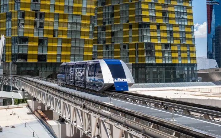
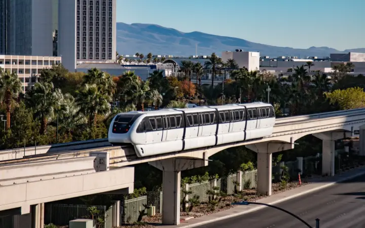
- Nothing free runs end to end. The two free trams serve only their own resorts and don’t connect, and the Monorail runs behind the east side from MGM Grand to SAHARA.
- The tourism office hedges. Visit Las Vegas says “the Strip is walkable, so if it’s close, walking might be your fastest option,” but warns first-timers who “assume it’s a breeze to walk from one end of the Strip to the other.”
Treat an end-to-end walk as an outing in itself, best on a mild day with plenty of stops, not as a way to get somewhere. Otherwise, walk the section you’re in and ride the rest: the Las Vegas Monorail takes about 15 minutes from MGM Grand to SAHARA, and our guide to Las Vegas without a car covers the Deuce bus and taxis.
How long is the Las Vegas Strip?
Between 4.2 and 5 miles, depending on the source, and the figure you’ll see most often isn’t the official one.
| Source | Length | What it covers |
|---|---|---|
| Federal Highway Administration | 4.5 miles (7.2 km) | The Strip’s All-American Road listing; no end points named |
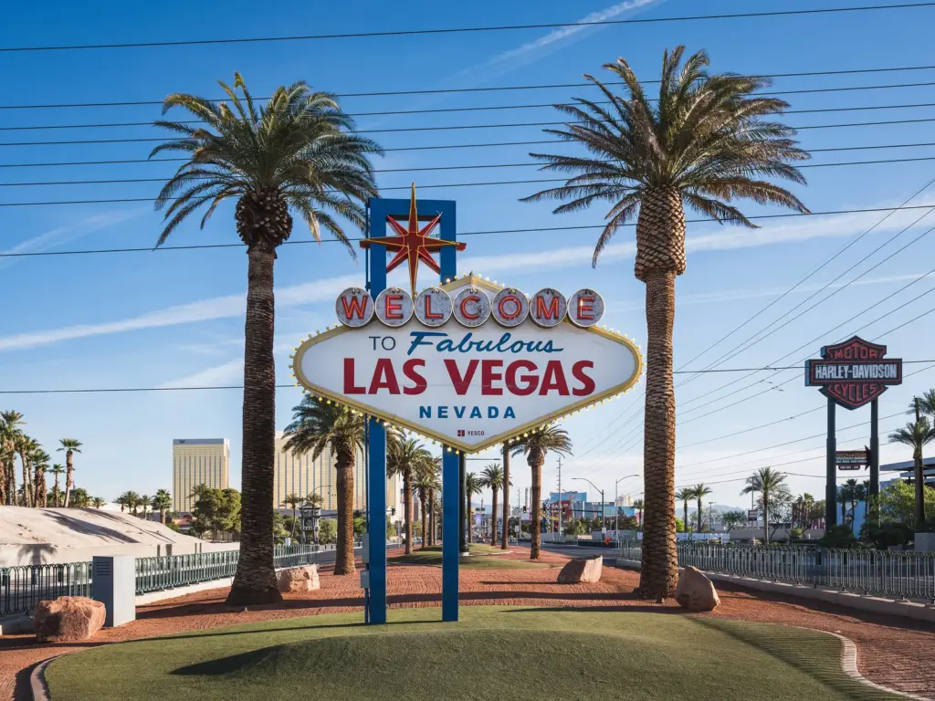
| Travel Nevada, the state tourism office | “Five miles” | “Bookended by the towering STRAT on the north end” and the Welcome to Fabulous Las Vegas sign at the south |
| National Scenic Byway Foundation | 4.5 miles | Starts at Las Vegas Blvd and East Sahara Ave |
| Wikipedia, repeated by the Las Vegas Review-Journal and Las Vegas Advisor | 4.2 miles | A reference and press figure, not an official one |
| Las Vegas Monorail | 3.9 miles | The rail line behind the east side, not the boulevard |
The fair reading is about 4.2 to 4.5 miles, depending on where you start and stop.
How long does it take to walk the Las Vegas Strip?
There’s no official answer: none of the hotel, county or tourism sources we checked publishes an end-to-end time, so we don’t give one either. What the sources do support:
- Short hops take longer than they look. Harrah’s FAQ puts Caesars Palace 7 to 10 minutes away, and Caesars’ center-Strip hotels say most walks there take 5 to 15 minutes.
- Nothing free runs end to end. The two free trams serve only their own resorts and don’t connect, and the Monorail runs behind the east side from MGM Grand to SAHARA.
- The tourism office hedges. Visit Las Vegas says “the Strip is walkable, so if it’s close, walking might be your fastest option,” but warns first-timers who “assume it’s a breeze to walk from one end of the Strip to the other.”
Treat an end-to-end walk as an outing in itself, best on a mild day with plenty of stops, not as a way to get somewhere. Otherwise, walk the section you’re in and ride the rest: the Las Vegas Monorail takes about 15 minutes from MGM Grand to SAHARA, and our guide to Las Vegas without a car covers the Deuce bus and taxis.
Official walking times between hotels
Only a few operators publish walking times, and we use only theirs. All are the hotels’ own approximations.
Center Strip: Caesars’ figures
| From | To | Walking time (source) |
|---|---|---|
| Harrah’s | The LINQ Hotel | 2–3 minutes (Harrah’s FAQ) |
| Harrah’s | LINQ Promenade and High Roller | 5–6 minutes (Harrah’s FAQ) |
| Harrah’s | Flamingo | 5–7 minutes (Harrah’s FAQ) |
| Harrah’s | Horseshoe | 7–8 minutes (Harrah’s FAQ) |
| Harrah’s | Caesars Palace, at Flamingo Rd | 7–10 minutes (Harrah’s FAQ) |
| The LINQ Hotel lobby | High Roller | About 5–10 minutes (LINQ FAQ) |
| The Vanderpump Hotel entrance | Flamingo & Caesars Palace Monorail station | About 5–7 minutes (Vanderpump FAQ) |
| Planet Hollywood | Horseshoe & Paris Monorail station, through Paris | 10–15 minutes (Planet Hollywood FAQ) |
| Horseshoe | Paris, by the interior corridor | “Just a few minutes” (Horseshoe FAQ) |
South Strip: MGM’s times to T-Mobile Arena
MGM publishes approximate distances and times from its resorts to T-Mobile Arena, set back from the boulevard at Park Avenue, and they double as a yardstick for the south Strip.
| Hotel | Distance | Time (MGM) |
|---|---|---|
| Park MGM | 0.2 mile | Under 5 minutes |
| New York-New York | 0.3 mile | Under 5 minutes |
| MGM Grand | 0.4 mile | 10 minutes |
| ARIA | 0.4 mile | 10 minutes* |
| The Signature at MGM Grand | 0.5 mile | 12 minutes |
| Vdara | 0.5 mile | 12 minutes* |
| Excalibur | 0.6 mile | 10–15 minutes |
| Luxor | 0.8 mile | 15–20 minutes |
| Bellagio | 1 mile | 15–20 minutes* |
| Mandalay Bay, W Las Vegas, Four Seasons | 1.1 miles | 20–25 minutes* |
*Partly by tram. MGM adds that from resorts north of Flamingo Road, taxi or rideshare is the preferred way to the arena. See our guides to hotels near T-Mobile Arena and, for game days at the south end, hotels near Allegiant Stadium.
We found no official time for many obvious pairs, such as Mandalay Bay to Luxor, Bellagio to Caesars Palace or Wynn to Fashion Show. Sphere, off the boulevard, has its own published routes in our guide to hotels near Sphere.
Las Vegas Strip hotels in order, south to north
Official street numbers follow a handy pattern: even on the west side, odd on the east (our observation from the addresses, not an official rule). All addresses below are on Las Vegas Blvd S.
| Stretch, south to north | West side (Bellagio side) | East side (Paris side) |
|---|---|---|
| Welcome to Fabulous Las Vegas sign (5200) to Tropicana Ave | Four Seasons (3960), Mandalay Bay (3950), W Las Vegas (3940), Luxor (3900), Excalibur (3850) | Former Tropicana site, now A’s ballpark construction |
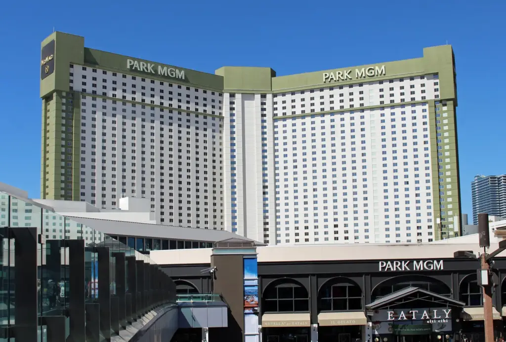
| Tropicana Ave to Harmon Ave | New York-New York (3790), then Park Ave toward T-Mobile Arena, Park MGM (3770) and The Reserve, Waldorf Astoria (3752), ARIA (3730) with The Shops at Crystals (3720) | MGM Grand (3799), Hilton Vacation Club Polo Towers (3745) |
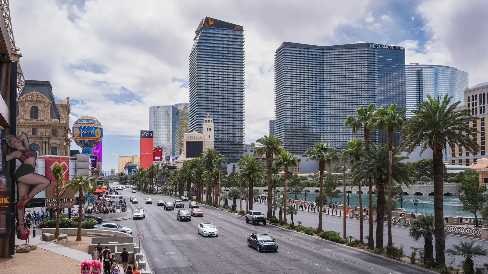
| Harmon Ave to Flamingo Rd | The Cosmopolitan (3708), Bellagio (3600) | Planet Hollywood and the Miracle Mile Shops (3667), Paris (3655), Horseshoe (3645) |
| Flamingo Rd to Spring Mountain Rd/Sands Ave | Caesars Palace and Nobu Hotel (3570), former Mirage site (Hard Rock planned for 2027), Treasure Island (3300) | The Vanderpump Hotel (3595), Flamingo (3555), The LINQ (3535), Harrah’s (3475), Best Western Plus Casino Royale (3411), The Venetian (3355), The Palazzo (3325) |
| Spring Mountain Rd/Sands Ave to Sahara Ave | Fashion Show mall (3200), Resorts World (3000), Circus Circus (2880), Hilton Grand Vacations Club on The Strip (2650) | Wynn and Encore (3131), Fontainebleau (2777), SAHARA (2535) |
| North of Sahara Ave | The STRAT (2000) | None |
Two easy mistakes: Paris and Planet Hollywood are next-door neighbors on the east side, with the Bellagio fountains across the boulevard from Paris, and at Flamingo Road, Horseshoe is diagonal from Caesars Palace, not directly across.
Where to cross: the pedestrian bridges
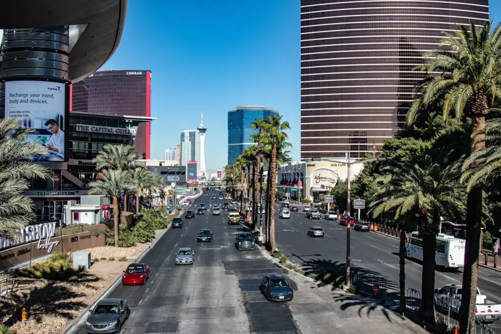
Clark County’s bridge map (dated July 21, 2026, and checked again in October 2026) shows 14 pedestrian bridges at five intersections, 12 of them open, each with ADA-compliant elevators and escalators. The county doesn’t describe them as enclosed or air-conditioned, so treat every crossing as an outdoor stretch.
| Intersection | On the corners | Bridges |
|---|---|---|
| Tropicana Ave | Excalibur (SW), New York-New York (NW), MGM Grand (NE), former Tropicana site (SE) | Excalibur to New York-New York over Tropicana Ave; New York-New York to MGM Grand over Las Vegas Blvd; two to the former Tropicana corner, closed |
| Park Ave | New York-New York (SW), Park MGM (NW) | One over Las Vegas Blvd, from the Park MGM corner to the east side |
| Harmon Ave | ARIA and Crystals (SW), The Cosmopolitan (NW), Planet Hollywood (NE) | One over Las Vegas Blvd from The Cosmopolitan side to the Planet Hollywood corner; one over Harmon Ave on the east side |
| Flamingo Rd, the Four Corners | Bellagio (SW), Caesars Palace (NW), The Vanderpump Hotel (NE), Horseshoe (SE) | One on each leg, linking all four corners |
| Spring Mountain Rd/Sands Ave | Treasure Island (SW), Fashion Show (NW), Wynn and Encore (NE), The Palazzo (SE) | Fashion Show to Treasure Island over Spring Mountain Rd; Fashion Show to Wynn over Las Vegas Blvd; Wynn to The Palazzo over Sands Ave |
- Diagonals take two bridges: Caesars Palace to Horseshoe, or Treasure Island to Wynn.
- One bridge isn’t on the county map: Treasure Island says pedestrian bridges connect it to The Palazzo, The Venetian and The Venetian Expo.
- More are planned: near Resorts World and The LINQ, according to Clark County Public Works; for now, the county’s map shows none north of Spring Mountain Road.
- Elevators break down: the county publishes a dated list of units that are out of service, so check it if you rely on one.
To skip some sidewalks entirely, our guide to connected hotels in Las Vegas lists every indoor link and free tram.
Hotels sold as “Strip” that aren’t on Las Vegas Boulevard
Several hotels use “Strip” in their marketing, or get listed under it, without a boulevard address. If you plan to walk, check the street address, not the label.
| Hotel | Address | Visit Las Vegas region | What the hotel says |
|---|---|---|---|
| Vdara | 2600 W Harmon Ave | Strip | “An all-suite hotel at the center of the Las Vegas Strip” |
| The Signature at MGM Grand | 145 E Harmon Ave | Strip | Its home page doesn’t use the word “Strip” |
| Trump International | 2000 Fashion Show Dr | Off-Strip | A “luxury hotel on The Strip” |
| Westgate | 3000 Paradise Rd | Off-Strip | Lists the Strip as a “3-min drive” and promotes its Monorail station |
| Virgin Hotels Las Vegas | 4455 Paradise Rd | Off-Strip | No Strip claim recorded |
| Rio | 3700 W Flamingo Rd | Off-Strip | “Just Off The Strip. Right On The Value.” |
| Palms | 4321 W Flamingo Rd | Off-Strip | No Strip claim recorded |
Vdara is inside the ARIA Campus, behind ARIA, Bellagio and The Cosmopolitan; The Signature is behind MGM Grand; Trump is behind Fashion Show mall; and Westgate is next to the Las Vegas Convention Center. Even the labels disagree: Visit Las Vegas files The Signature under “Strip” and The Carriage House, at 105 E Harmon Ave, under “Off-Strip.”
Is the STRAT on the Strip?
By most travel definitions, yes. The STRAT, at 2000 Las Vegas Blvd S, sits on the west side north of Sahara Avenue; Visit Las Vegas lists it in its Strip region as the northernmost resort, and Travel Nevada calls it the Strip’s north bookend. Clark County’s stricter definition, as reported by Las Vegas Advisor, ends at Sahara Avenue, which leaves The STRAT just outside.
Is Resorts World on the Strip?
Yes. It’s at 3000 Las Vegas Blvd S on the west side of the north Strip, in Visit Las Vegas’s Strip region. Its three hotels, the Las Vegas Hilton, Conrad and Crockfords, have their own entrances on Resorts World Ave, so tell drivers which one you want.
Walking the Strip in the heat
Heat, more than distance, decides how far you’ll want to walk. Las Vegas averages 78 days a year at 100°F or hotter, per NOAA, and 2025 had 77, according to the Southern Nevada Health District.
| Month | Average high | Average days at 100°F or more |
|---|---|---|
| April | 78.5°F | 0 |
| May | 88.5°F | 2.8 |
| June | 99.4°F | 17.1 |
| July | 104.5°F | 25.8 |
| August | 102.8°F | 24.5 |
| September | 94.9°F | 7.9 |
| October | 81.2°F | 0.1 |
NOAA 1991–2020 normals, Harry Reid International Airport.
The Southern Nevada Health District advises scheduling outdoor activities for early morning or evening, drinking water regularly even if you’re not thirsty, limiting alcohol and wearing a hat, sunscreen and loose, light-colored clothing. Heavy sweating, cold and clammy skin, dizziness or nausea signal heat exhaustion: get somewhere cool and sip water. A body temperature of 103°F or higher or confusion can mean heat stroke, a medical emergency, so call 911. During a National Weather Service Extreme Heat Warning, the advice is to avoid outdoor activities, especially during the heat of the day.
Our Las Vegas packing list covers walking shoes and summer clothes. After dark it’s cooler, but plan the ride back: the free trams stop at midnight, the Monorail runs until midnight on Mondays, 2 a.m. Tuesday through Thursday and 3 a.m. Friday through Sunday, apart from some early closures in late 2026, and the RTC’s Deuce bus runs 24 hours. To weigh heat against hotel prices by month, see our guide to the cheapest time to visit Las Vegas.
Walking the Strip with kids, a stroller or a wheelchair
Kids can walk the Strip; plan around the heat and the casino floors.
- Heat: the health district puts children, adults 65 and older, pregnant people and people with chronic conditions at highest risk, and warns never to leave children or pets in a vehicle.
- Casinos: Nevada law bars anyone under 21 from loitering where gaming is conducted, so keep moving through casino shortcuts.
- Bridges: every county bridge has elevators as well as escalators.
- Monorail: it’s ADA compliant, with elevators at every station, and children 5 and under ride free when carried through the gates with a paying adult.
Our family hotels guide covers the best bases for kids.
Where to park to walk the Strip
Park where you’ll spend the most time, then walk and ride. Figures as of October 2026:
- Wynn: the first three hours of self-parking are free for everyone; after that, non-guests pay $25 a day.
- MGM resorts: visitors pay $20 per 24 hours Monday through Thursday and $25 Friday through Sunday, and registered hotel guests pay $20 a day.
- Events: prices can be higher during special events.
Our Las Vegas parking fees guide lists every hotel’s rates and free options.
Where to stay if you want to walk
Stay mid-Strip. By Caesars’ published times, Caesars Palace, Horseshoe, Flamingo and The LINQ are all within 10 minutes of Harrah’s on foot. Our guide to where to stay in Las Vegas compares the areas, our best hotels in Las Vegas list has the top picks, and the first-time Las Vegas guide covers the rest of the planning.
Downtown is a different walk: Fremont Street’s resorts sit close together under one canopy, but downtown is a ride from the Strip, not a walk. Our comparison of the Strip vs Downtown weighs the two bases, and our guide to getting from the Strip to Fremont Street covers the Deuce, taxis and rideshare.
Prices vary according to travel dates and availability.
FAQ
Can you walk the whole Las Vegas Strip?
Yes, it’s walkable, but end to end it’s a long outing rather than a stroll: about 1.5 hours nonstop at 3 mph by our estimate, or 2 to 3 hours with bridges and stops. Published lengths run from 4.2 to 5 miles, the free trams don’t connect, and July and August average highs top 100°F. Walk the section you’re in and ride the Monorail or the 24-hour Deuce bus for the long hauls.
Where does the Las Vegas Strip start and end?
At the Welcome to Fabulous Las Vegas sign in the south, at 5200 Las Vegas Blvd S, and, for most travel purposes, at The STRAT in the north, per Travel Nevada. Clark County’s definition, as reported by Las Vegas Advisor, runs from the sign to Sahara Avenue, just south of The STRAT.
What’s the best time of day to walk the Strip?
Early morning or evening, which is when the Southern Nevada Health District recommends scheduling outdoor activities in hot weather. Midday walks from June through August are the ones to avoid, since those months average highs from 99.4°F to 104.5°F. Late at night, plan the ride back: the free trams stop at midnight, while the Deuce bus runs 24 hours.
Can you walk from the Strip to Fremont Street?
Not in any practical way. No official source gives a walking route between the Strip and downtown, and even the Monorail, whose line ends at SAHARA, tells riders to take the Deuce or the free Downtown Loop from there. Add the summer heat and it’s a ride, not a walk; see how to get from the Strip to Fremont Street.
How do you get from one end of the Strip to the other without walking?
Ride the Monorail, which runs behind the east side from MGM Grand to SAHARA in about 15 minutes, or the RTC’s Deuce bus, which runs along the Strip 24 hours a day. Taxis can’t be hailed on the street, so use a hotel taxi line. From Mandalay Bay, take the free tram to Excalibur and cross the bridges through New York-New York to MGM Grand’s Monorail station.
Photo credits
- Photo: Christian David, CC BY-SA 4.0 via Wikimedia Commons
- Photo: Christian David, CC BY-SA 4.0 via Wikimedia Commons
- Photo: Han Zheng, CC BY-SA 2.0 via Wikimedia Commons
- Photo: Coolcaesar, CC BY-SA 4.0 via Wikimedia Commons